LiDAR vs 360 Cameras: Which is Better for the Restoration Industry?

If you’re looking for an imaging solution for documentation, there are many different options. Between 360˚ cameras and LiDAR, it can be difficult to figure out which method is right for you.
As people who specialize in the restoration industry, we’ll outline which option we feel is the best fit based on the type of work you perform every day.
Summary
- LiDAR and 360 cameras are both great options for the restoration industry, but LiDAR has certain drawbacks that 360˚ cameras don’t
- LiDAR’s strengths are in mitigation, while 360˚ cameras work well for both mitigation and reconstruction restoration
- LiDAR is incredibly convenient and has amazing capabilities within Apple’s iOS
- 360˚ cameras create a geospatial walkthrough, which is highly accurate and useful
What is LiDAR?
LiDAR, or Light Detection and Ranging, is technology that uses laser pulses to measure distances to objects. While use cases range from self-driving cars to geographical and agriculture mapping, some also use this technology for construction and real estate in order to produce spatial maps and floorplans.
Types include mobile LiDAR, LiDAR attachments, and LiDAR devices like Leica BLK360.
LiDAR vs 360˚Cameras in restoration work
LiDAR and 360˚ cameras are used for the same purpose during the documentation process: to capture an accurate floor plan, including measurements, that are used to settle claims and for reconstruction.
We’ll compare LiDAR and 360˚ camera technology on three different aspects: accuracy and precision, condition requirements, and time spent on the estimate.
Accuracy & precision
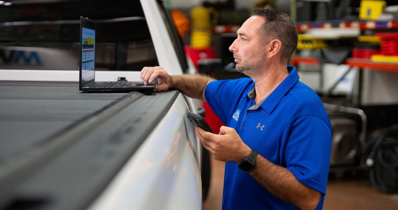
Using LiDAR on your smartphone might be convenient, but it’s not efficient or precise. Here’s why.
LiDAR struggles with accuracy
According to Apple’s developer site, LiDAR on the iPhone is suitable for room scanning and measurement, but “may not meet the needs of those that require greater precision depth.”
Let’s break down what that means for estimators.
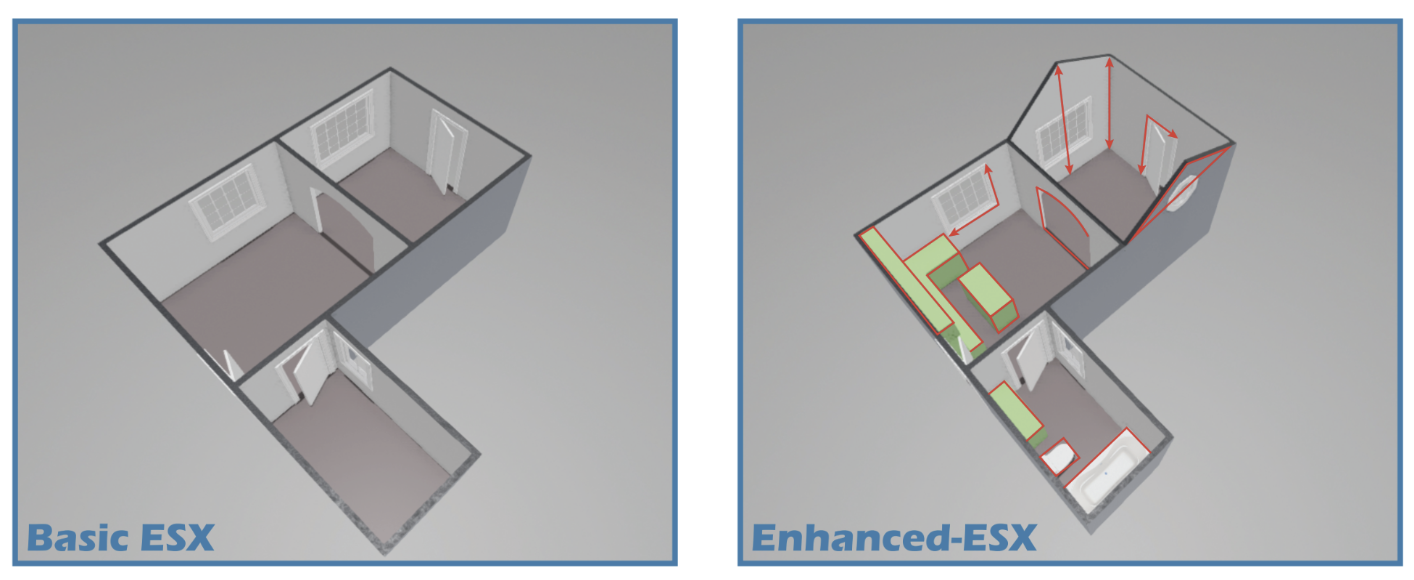
- Helpful for mitigation. LiDAR is able to generate an instant sketch and 3D rendering, which is useful for mitigation work. It will provide you with a loose floor plan you can use to communicate damage.
- Ineffective for pre and reconstruction. Once you reach the pre and reconstruction phases –– where measurements need to be perfect –– it becomes a less-than-ideal solution because these sketches have accuracy issues. You’ll probably need to revisit the sketch and manually adjust certain measurements, which can be very time-consuming and create issues during the estimation process. If you create and submit your mitigation estimate prior to manually updating your sketch, your rebuild estimate will not align and it will be a big headache for you.
- Real implications for clients.If any details affecting the cost of labor or materials are underrepresented, it will be difficult to secure payment for the difference later on.
- More room for user error. If the user doesn’t hold the camera with precise accuracy, the resulting sketch may be inaccurate. Conversely, 360˚ cameras don’t require that level of manual precision: the tech just needs to set it up on a tripod and they’re good to go.
360˚ cameras produce more accurate sketches
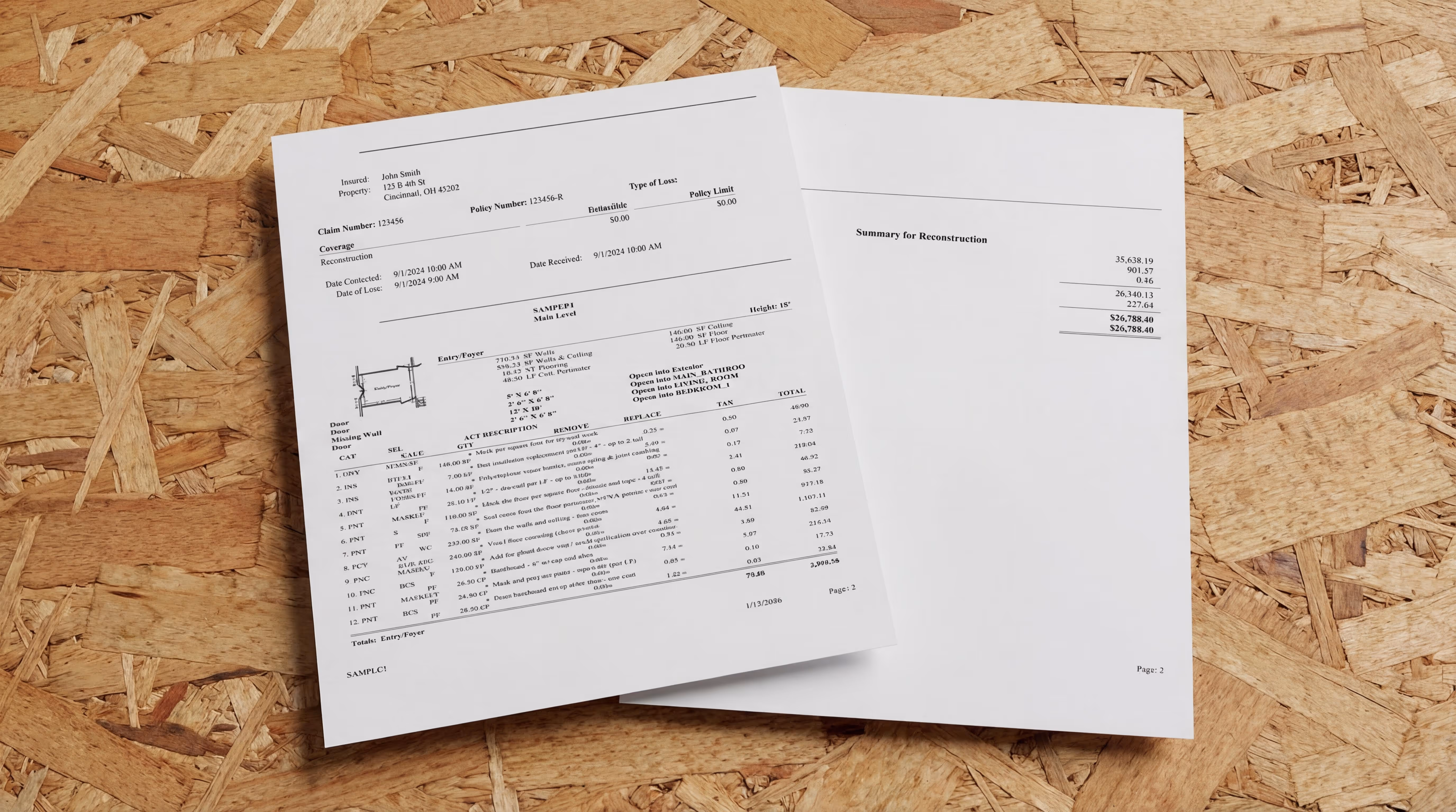
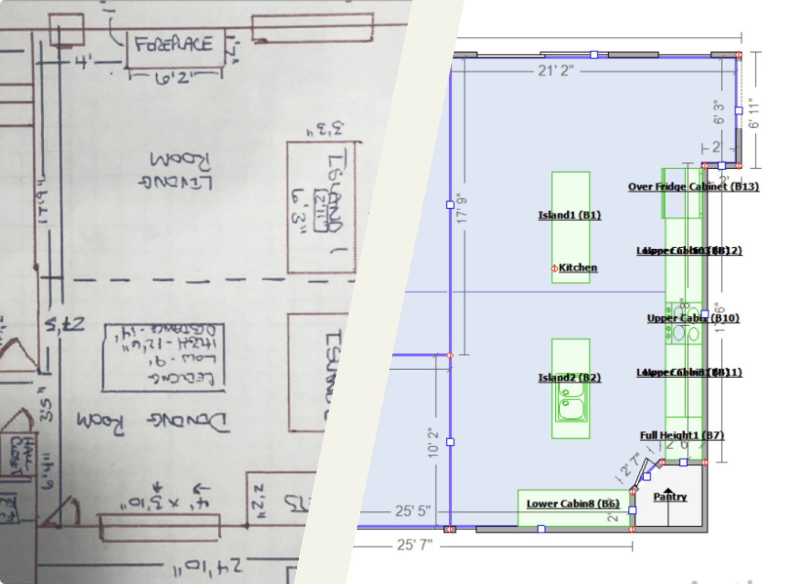
Floor plans need to be highly accurate in order to ensure a proper claim submission.
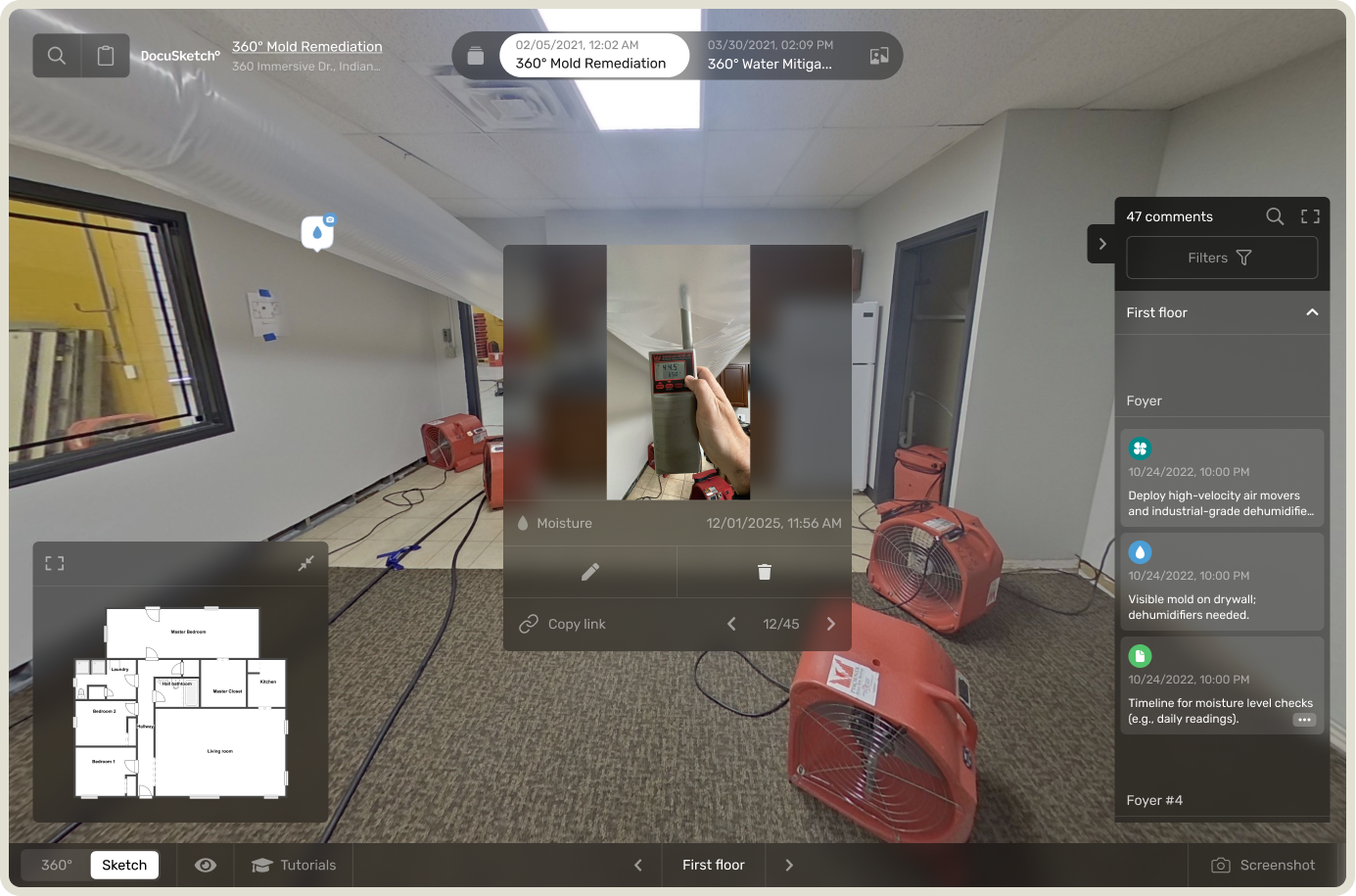
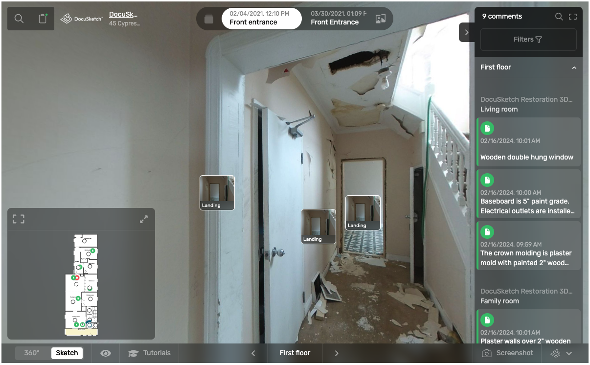
Not only do 360˚ camera captures provide the content for a highly accurate sketch, they also produce a full visual, geospatial record. This creates full and indisputable transparency for homeowners, subcontractors, and insurance carriers alike.
📚 Resource: Manual Sketching is a Thing of the Past – Here’s Why
This is an immersive walkthrough like the ones you’ve likely seen on Zillow. LiDAR, on the other hand, only provides a blueprint of a space – you won’t get a photo tour, just an outline.
Condition requirements
360˚ cameras don’t experience the same issues that LiDAR does when used in the types of conditions that are common for estimators to encounter.
LiDAR has difficulty with certain types of conditions
Reflective surfaces
As LiDAR uses lasers to map distances between objects, it has difficulties with reflective surfaces and objects like windows, mirrors, and glass.
The result is “ghost objects” or “ghost detections,” where the LiDAR sees and maps an object that isn’t really there.
This can create inaccuracies in documentation and the estimate, especially in a hybrid estimating situation where one person is creating a tour but someone different creates the estimate.
Low light and high moisture
LiDAR has sensitivity to ambient lighting and moisture conditions.
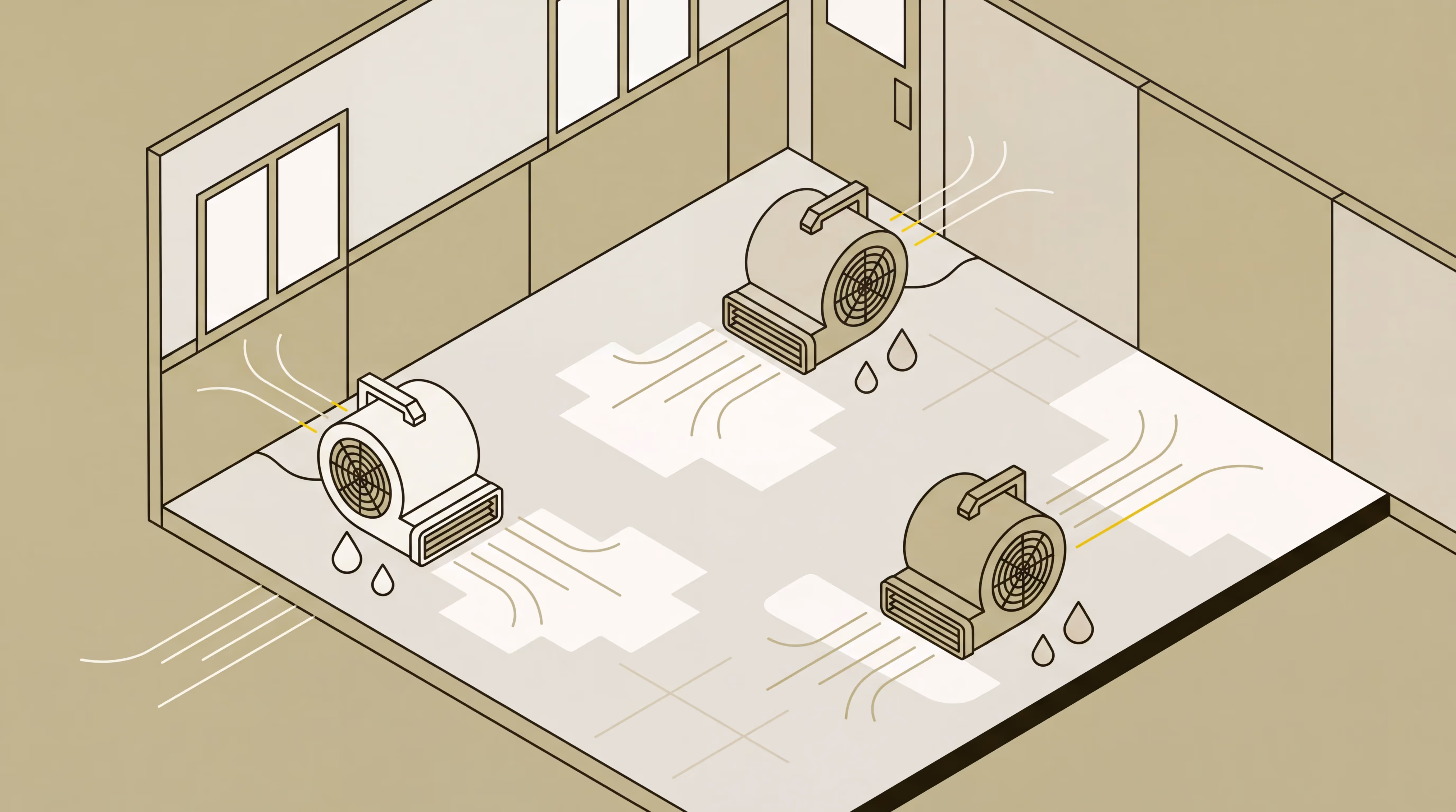
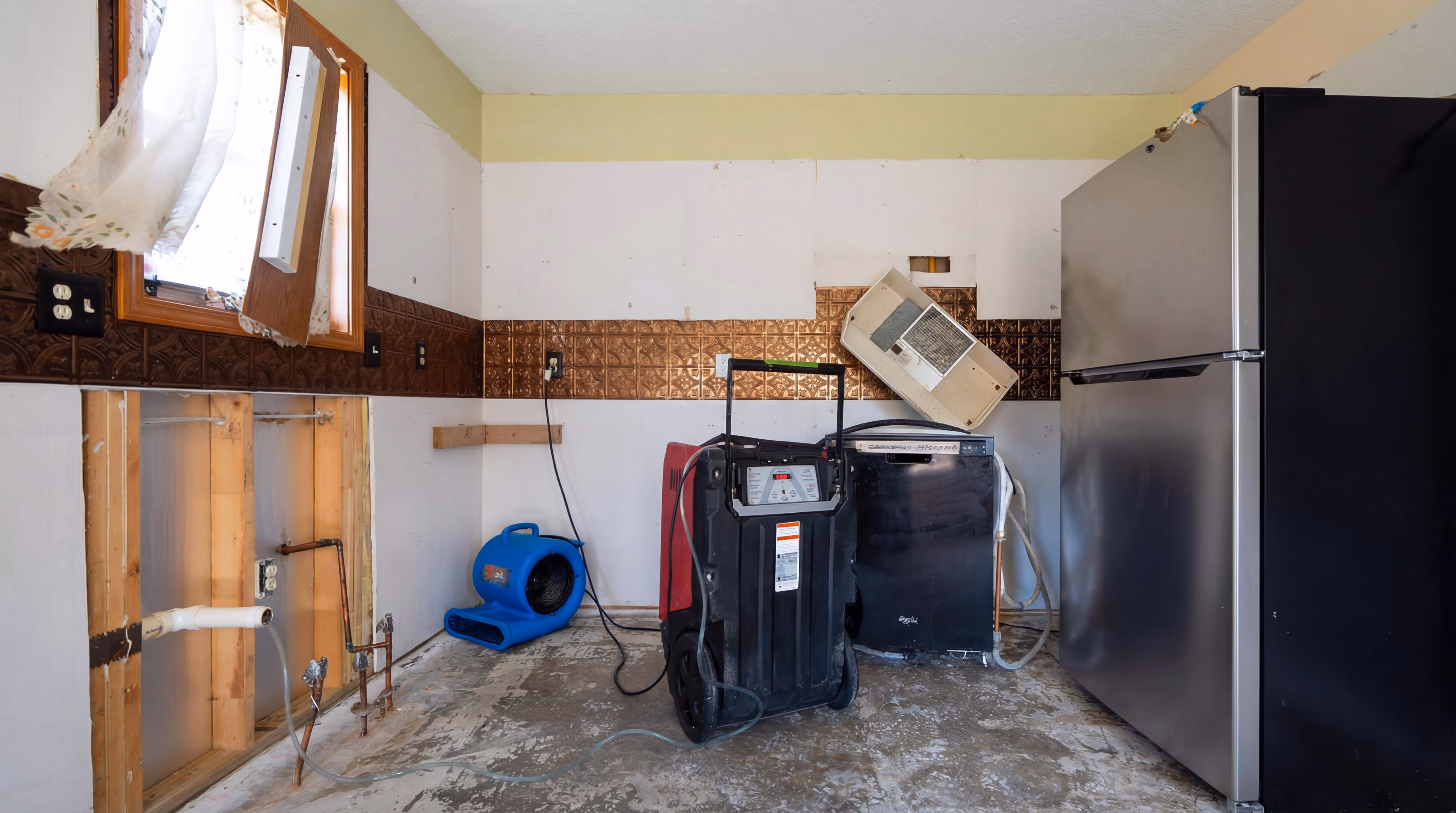
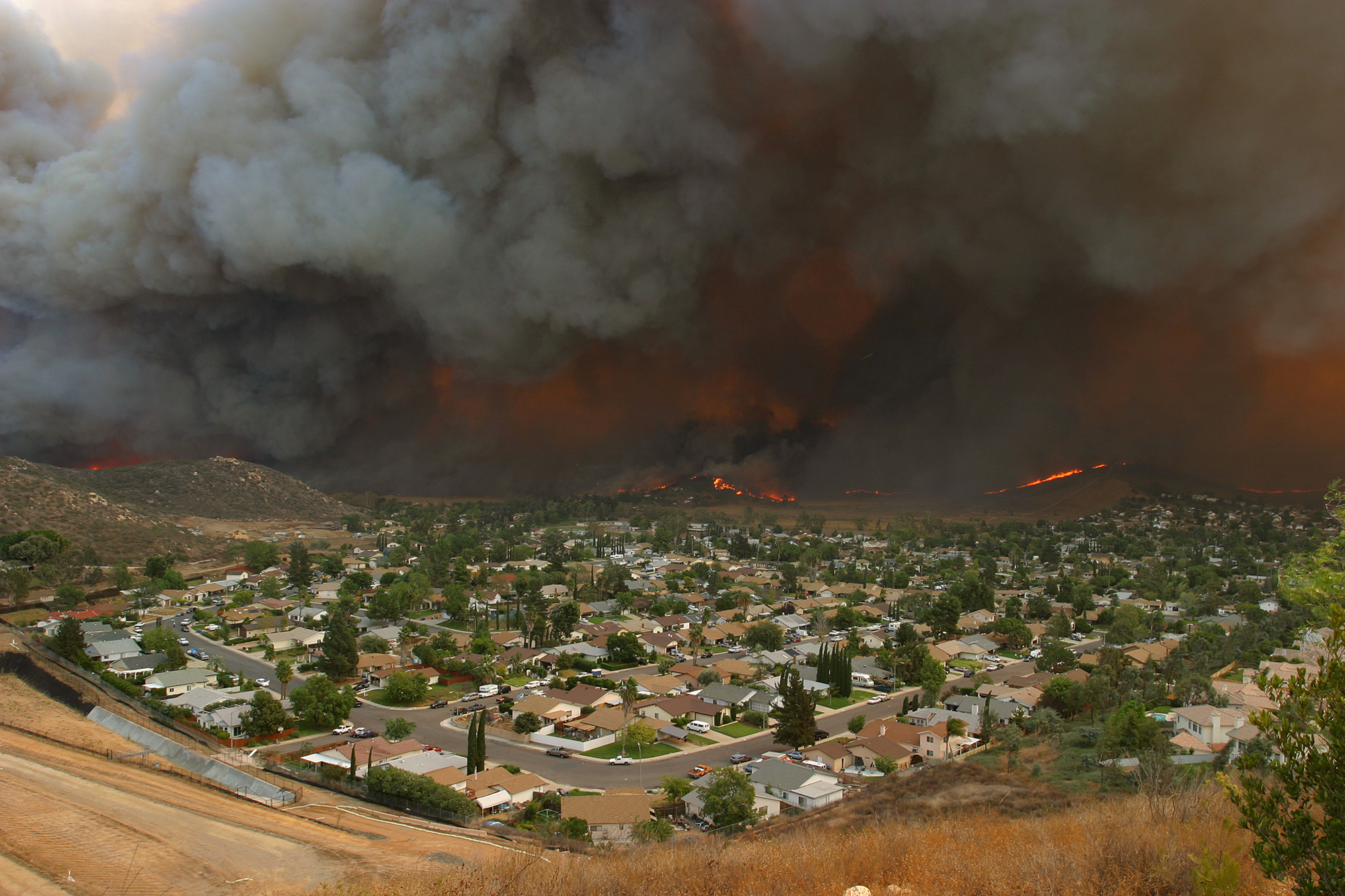
In restoration environments, properties are often affected by water damage or fire, resulting in damp conditions and limited or no lighting.
These challenging circumstances can cause LiDAR to produce inaccurate measurements, ultimately leading to imprecise claims submissions.
Over time, these inaccuracies can result in significant financial loss, as claims may be undervalued, leaving money on the table. The impact compounds with each claim, affecting their bottom line month after month.
360˚ cameras don’t experience same issues that LiDAR experiences
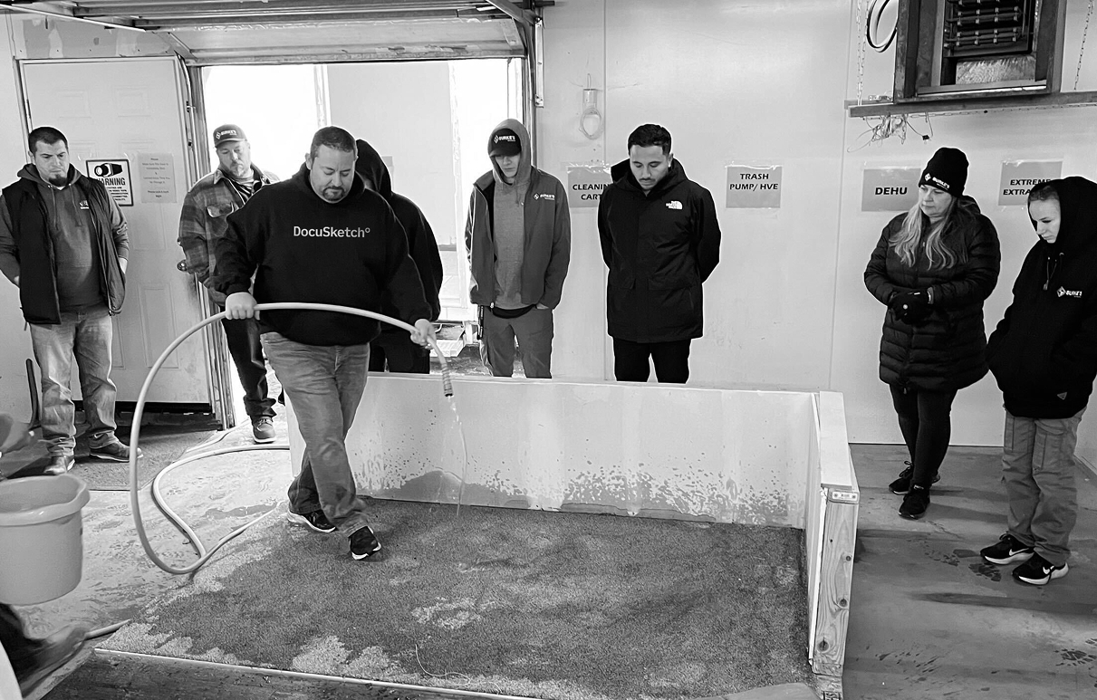
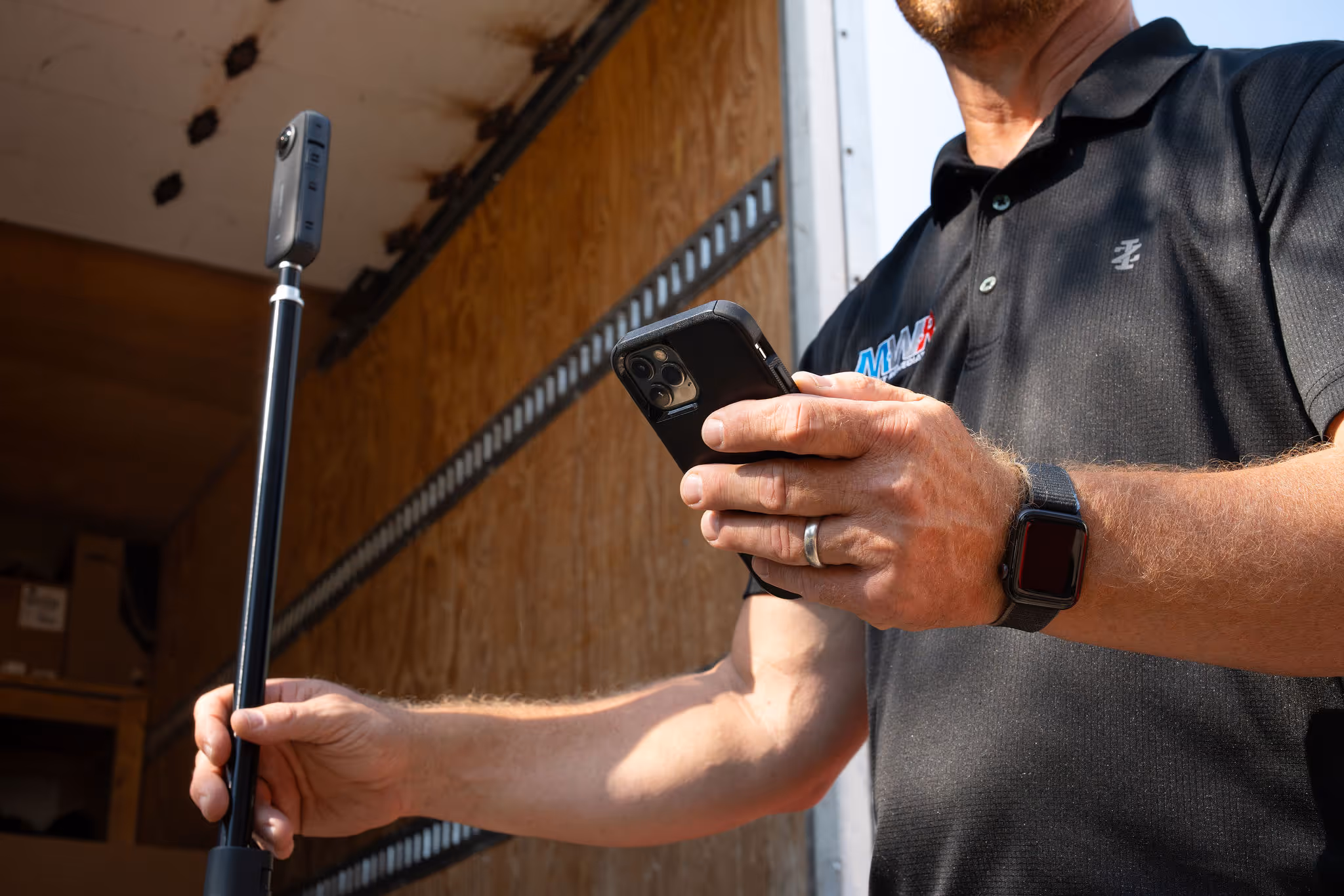
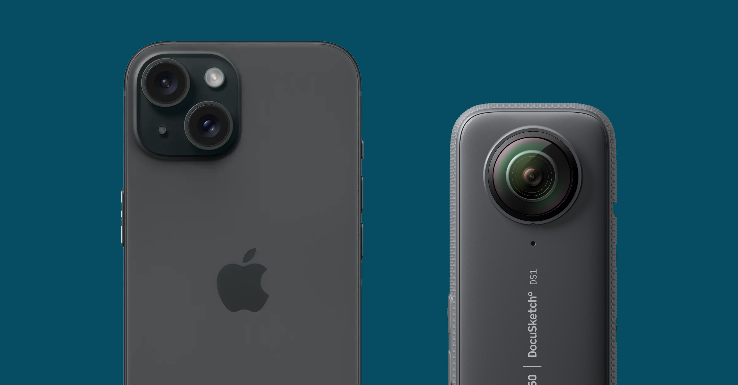
You don’t have to worry about dealing with these issues when it comes to 360˚ cameras. Ghost objects won’t happen, as you’re capturing an actual photographic record of the space. And, cameras like the DocuSketch 360 Camera can actually be used to capture night scenes. If you’re capturing in wet conditions, they even sell an attachment that makes the camera waterproof.
Time spent on estimate
With a faster capture time and accurate sketch, 360˚ cameras win in terms of time spent on estimates overall.
LiDAR takes longer on site
While LiDAR is able to generate an instant sketch and 3D rendering, it takes longer to actually capture a full space while on site.
Plus, once the sketch comes back, estimators often have to spend time re-adjusting things like walls if a faulty measurement comes back.
As you know, this time spent is legitimately wasting money for you. The busywork could take up operational revenue, sales, and stop your estimators from getting to more jobs.
⚠️ Note: The LiDAR camera is only available on certain Apple devices, includingthe iPhone 12 Pro or later, iPad Pro 11-inch (3rd generation) or later, and the iPad Pro 12.9-inch (5th generation) or later. So, you’ll need to ensure anyone who is traveling to the jobsite has one of these devices, or purchase one specifically for them to use.
360˚ camera is speedy and professional
A capture done with a 360˚ camera takes minutes. According to a recent study conducted by DocuSketch’s VP of Product Innovation, it took just 8 minutes to capture his one story, 1400 square foot house in Arizona.
If you’re using DocuSketch, you can receive your sketch back in as quickly as 5 hours, and a real human reviews the sketch for accuracy to ensure you’re getting exactly what you need, eliminating any time spent re-adjusting the estimate.
Plus, using a 360° camera provides a better experience for the policyholder. When you set up a 360˚ camera at a jobsite rather than using your smartphone, it’s a sign of professionalism. It also allows you to multitask and chat with the homeowner to speak to any concerns. The added bonus? Homeowners can have the sketch when you’re done, which they’ll appreciate for future projects.
Get started with 360˚camera captures
360˚ cameras, like the DocuSketch 360 Camera pair perfectly with DocuSketch, which is designed specifically for the restoration industry. This will make the set up process for you easier, creating a smooth transition from the previous methods you’ve been using.
DocuSketch allows you to save 90% of time documenting and is thorough and incredibly accurate, laying the right foundation for a successful claims process.
Plus, real people look at and approve the sketch – our process is not reliant on AI alone.
By ditching LiDAR and leveraging tech that’s truly designed to function as the sidekick for restoration businesses, you’ll save money, time, and generate more accurate estimates.
DocuSketch supports 360˚camera scans for restoration companies by providing the 360˚capture, a precise digital floor plan, and the estimate all in one place.
- Create documentation that improves accuracy and speeds up processes
- Make 360° photo tours in under 20 seconds per room
- Add text, picture, voice, and video comments for your scope and claim description
- Share documentation with your team, subcontractors, TPA, or insurance adjuster
If you’re looking for an imaging solution for documentation, there are many different options. Between 360˚ cameras and LiDAR, it can be difficult to figure out which method is right for you.
As people who specialize in the restoration industry, we’ll outline which option we feel is the best fit based on the type of work you perform every day.
Summary
- LiDAR and 360 cameras are both great options for the restoration industry, but LiDAR has certain drawbacks that 360˚ cameras don’t
- LiDAR’s strengths are in mitigation, while 360˚ cameras work well for both mitigation and reconstruction restoration
- LiDAR is incredibly convenient and has amazing capabilities within Apple’s iOS
- 360˚ cameras create a geospatial walkthrough, which is highly accurate and useful
What is LiDAR?
LiDAR, or Light Detection and Ranging, is technology that uses laser pulses to measure distances to objects. While use cases range from self-driving cars to geographical and agriculture mapping, some also use this technology for construction and real estate in order to produce spatial maps and floorplans.
Types include mobile LiDAR, LiDAR attachments, and LiDAR devices like Leica BLK360.
LiDAR vs 360˚Cameras in restoration work
LiDAR and 360˚ cameras are used for the same purpose during the documentation process: to capture an accurate floor plan, including measurements, that are used to settle claims and for reconstruction.
We’ll compare LiDAR and 360˚ camera technology on three different aspects: accuracy and precision, condition requirements, and time spent on the estimate.
Accuracy & precision
Using LiDAR on your smartphone might be convenient, but it’s not efficient or precise. Here’s why.
LiDAR struggles with accuracy
According to Apple’s developer site, LiDAR on the iPhone is suitable for room scanning and measurement, but “may not meet the needs of those that require greater precision depth.”
Let’s break down what that means for estimators.
- Helpful for mitigation. LiDAR is able to generate an instant sketch and 3D rendering, which is useful for mitigation work. It will provide you with a loose floor plan you can use to communicate damage.
- Ineffective for pre and reconstruction. Once you reach the pre and reconstruction phases –– where measurements need to be perfect –– it becomes a less-than-ideal solution because these sketches have accuracy issues. You’ll probably need to revisit the sketch and manually adjust certain measurements, which can be very time-consuming and create issues during the estimation process. If you create and submit your mitigation estimate prior to manually updating your sketch, your rebuild estimate will not align and it will be a big headache for you.
- Real implications for clients.If any details affecting the cost of labor or materials are underrepresented, it will be difficult to secure payment for the difference later on.
- More room for user error. If the user doesn’t hold the camera with precise accuracy, the resulting sketch may be inaccurate. Conversely, 360˚ cameras don’t require that level of manual precision: the tech just needs to set it up on a tripod and they’re good to go.
360˚ cameras produce more accurate sketches
Floor plans need to be highly accurate in order to ensure a proper claim submission.
Not only do 360˚ camera captures provide the content for a highly accurate sketch, they also produce a full visual, geospatial record. This creates full and indisputable transparency for homeowners, subcontractors, and insurance carriers alike.
📚 Resource: Manual Sketching is a Thing of the Past – Here’s Why
This is an immersive walkthrough like the ones you’ve likely seen on Zillow. LiDAR, on the other hand, only provides a blueprint of a space – you won’t get a photo tour, just an outline.
Condition requirements
360˚ cameras don’t experience the same issues that LiDAR does when used in the types of conditions that are common for estimators to encounter.
LiDAR has difficulty with certain types of conditions
Reflective surfaces
As LiDAR uses lasers to map distances between objects, it has difficulties with reflective surfaces and objects like windows, mirrors, and glass.
The result is “ghost objects” or “ghost detections,” where the LiDAR sees and maps an object that isn’t really there.
This can create inaccuracies in documentation and the estimate, especially in a hybrid estimating situation where one person is creating a tour but someone different creates the estimate.
Low light and high moisture
LiDAR has sensitivity to ambient lighting and moisture conditions.
In restoration environments, properties are often affected by water damage or fire, resulting in damp conditions and limited or no lighting.
These challenging circumstances can cause LiDAR to produce inaccurate measurements, ultimately leading to imprecise claims submissions.
Over time, these inaccuracies can result in significant financial loss, as claims may be undervalued, leaving money on the table. The impact compounds with each claim, affecting their bottom line month after month.
360˚ cameras don’t experience same issues that LiDAR experiences
You don’t have to worry about dealing with these issues when it comes to 360˚ cameras. Ghost objects won’t happen, as you’re capturing an actual photographic record of the space. And, cameras like the DocuSketch 360 Camera can actually be used to capture night scenes. If you’re capturing in wet conditions, they even sell an attachment that makes the camera waterproof.
Time spent on estimate
With a faster capture time and accurate sketch, 360˚ cameras win in terms of time spent on estimates overall.
LiDAR takes longer on site
While LiDAR is able to generate an instant sketch and 3D rendering, it takes longer to actually capture a full space while on site.
Plus, once the sketch comes back, estimators often have to spend time re-adjusting things like walls if a faulty measurement comes back.
As you know, this time spent is legitimately wasting money for you. The busywork could take up operational revenue, sales, and stop your estimators from getting to more jobs.
⚠️ Note: The LiDAR camera is only available on certain Apple devices, includingthe iPhone 12 Pro or later, iPad Pro 11-inch (3rd generation) or later, and the iPad Pro 12.9-inch (5th generation) or later. So, you’ll need to ensure anyone who is traveling to the jobsite has one of these devices, or purchase one specifically for them to use.
360˚ camera is speedy and professional
A capture done with a 360˚ camera takes minutes. According to a recent study conducted by DocuSketch’s VP of Product Innovation, it took just 8 minutes to capture his one story, 1400 square foot house in Arizona.
If you’re using DocuSketch, you can receive your sketch back in as quickly as 5 hours, and a real human reviews the sketch for accuracy to ensure you’re getting exactly what you need, eliminating any time spent re-adjusting the estimate.
Plus, using a 360° camera provides a better experience for the policyholder. When you set up a 360˚ camera at a jobsite rather than using your smartphone, it’s a sign of professionalism. It also allows you to multitask and chat with the homeowner to speak to any concerns. The added bonus? Homeowners can have the sketch when you’re done, which they’ll appreciate for future projects.
Get started with 360˚camera captures
360˚ cameras, like the DocuSketch 360 Camera pair perfectly with DocuSketch, which is designed specifically for the restoration industry. This will make the set up process for you easier, creating a smooth transition from the previous methods you’ve been using.
DocuSketch allows you to save 90% of time documenting and is thorough and incredibly accurate, laying the right foundation for a successful claims process.
Plus, real people look at and approve the sketch – our process is not reliant on AI alone.
By ditching LiDAR and leveraging tech that’s truly designed to function as the sidekick for restoration businesses, you’ll save money, time, and generate more accurate estimates.
DocuSketch supports 360˚camera scans for restoration companies by providing the 360˚capture, a precise digital floor plan, and the estimate all in one place.
- Create documentation that improves accuracy and speeds up processes
- Make 360° photo tours in under 20 seconds per room
- Add text, picture, voice, and video comments for your scope and claim description
- Share documentation with your team, subcontractors, TPA, or insurance adjuster

Related Articles


%20(1).jpg)